

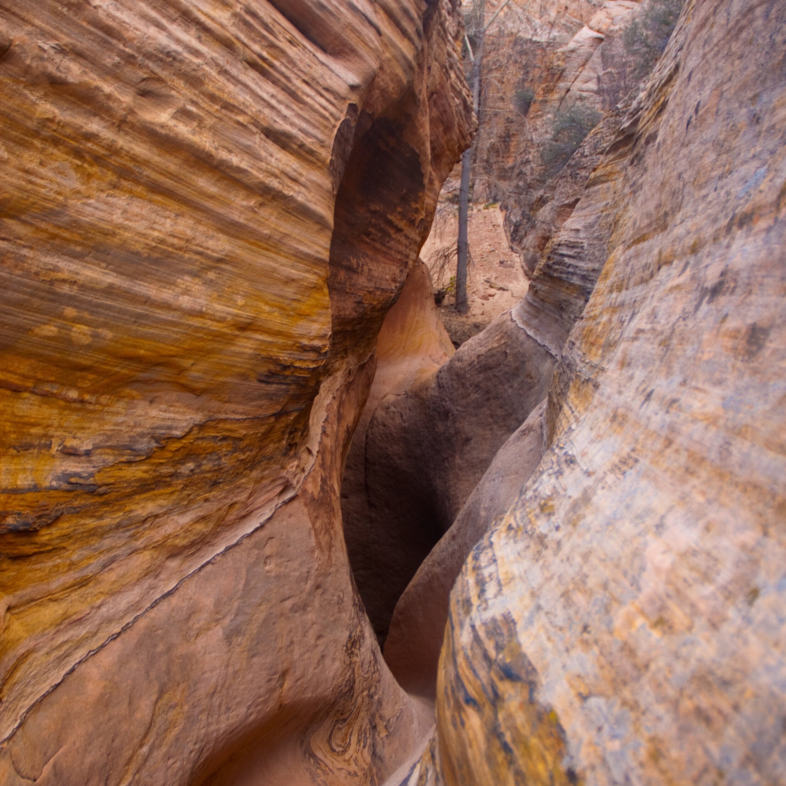
Wolverine
This amazing hike will lead you into Windgate Sandstone with sheer walls that narrow to about 3 ft across and reach heights of over 700 ft. As the canyon narrows you will be in awe of what the natural art gallery has on display, including arches and stone catacombs delicately placed by natures erosive hand. This truly magical place was created by volcanic activity that flourished over 250 million years ago, leaving behind hardened cinder cones offering a variety of purple hues with a breathtaking background. Due to the volcanic activity and mother nature’s talent, a unique geological phenomenon has created an abundance of petrified trees, another highlight of the trip. There are several different routes you can choose from depending on your time frame and ability.
The hike can loop into Little Death Hollow.
Distance: 6 miles
Difficulty: Easy/Moderate
Season: Spring/early Summer (April-June) and late Fall (Mid September-November)

Zebra and Tunnel Slots
A moderate hike to a short, spectacular slot known for its unique pattern of pink and white stripes which are extremely photogenic. Hike starts about 8 miles down the Hole-in-the-Rock road. Climbing and stemming are required to reach the main part of the slot and negotiate a small pour-off. Carrying large packs should be avoided as the narrows are narrow. Not a good hike on hot days. May require swimming.
Distance: 5 miles round-trip
Difficulty: Moderate
Season: Spring/early Summer (April-June) and late Summer/Fall (August-November)
Peek-a-boo and Spooky Slot Canyon
Although this hike is popular, it is not easy to navigate. This non-technical but challenging loop hike will cover two uniquely different slot narrows (not intended for those that are claustrophobic). Peek-a-boo is an easy scramble up a rock ledge where you’ll find yourself needing to crawl over more small sandstone entrances which access stone sculptured chambers with several arches that you pass through to reach the end (or the beginning) of this amazingly sculptured wonderland. Spooky slot canyons boast serpentine curves, arches, pour overs, tunnels and occasional choke stones. The slot gets fairly tight in areas warranting a side (vs frontal) approach to pass. The twists and turns of this slot canyon create an eerie and haunting nature, hence the name Spooky. This loop hike includes panoramic views over Hole-in-the-Rock road and it’s amazing playground. This exciting and fun hike is great for all ages.
Distance: 3 miles
Difficulty: Moderate
Season: Spring/early Summer (April-June) and Fall (Mid September-November)
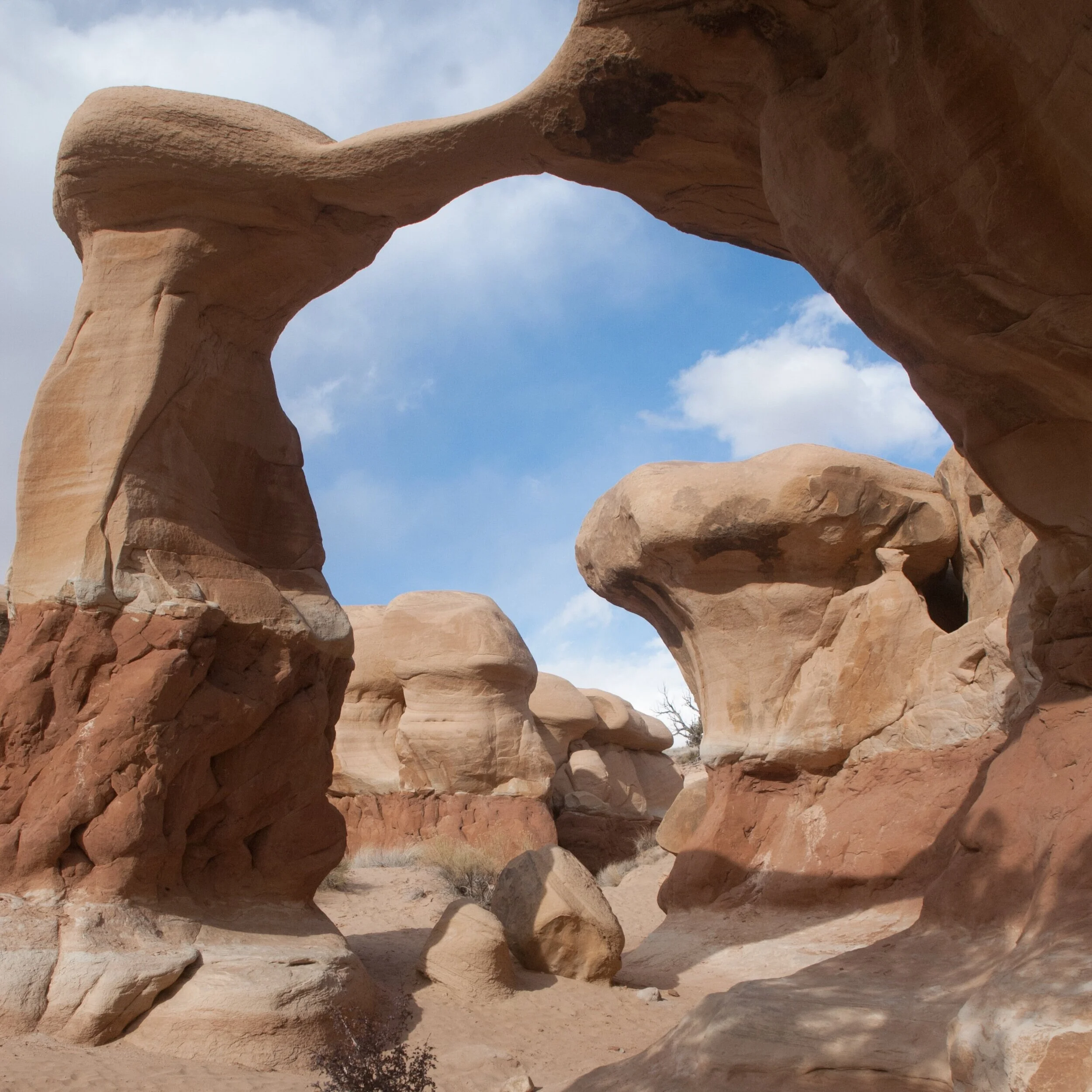
Devil’s Garden
The Devils Garden is located in the Grand Staircase-Escalante area, on the Hole-in-the-Rock Road, 12 miles south of Highway 12 and the town of Escalante. There are several trails and you are welcome to meander in any direction amongst standstone hoodoo formations and arches. A great place for young family members to play around in.

Lower Calf Creek
Definitely the most popular hike in the area. Enjoy mineral-streaked cliffs of Navajo Sandstone, beaver ponds and prehistoric rock sites all alongside the creek. End your journey with a 126-foot high waterfall and sit back and enjoy a snack with a view.
How to get there from the Ranch: Turn right onto Hell’s Backbone Road towards Hwy 12. Turn right (south) onto Hwy 12 (south) and head approximately 11 miles. On your right will be the clearly marked turnoff to the Calf Creek Recreation Area with a clearly visible campground. The trail-head starts at the campground. Make sure to grab a trail map here as there are many points of interest along the way.
Distance: 5.5 miles round-trip
Difficulty: Easy to moderate
Season: Spring/Summer/Fall
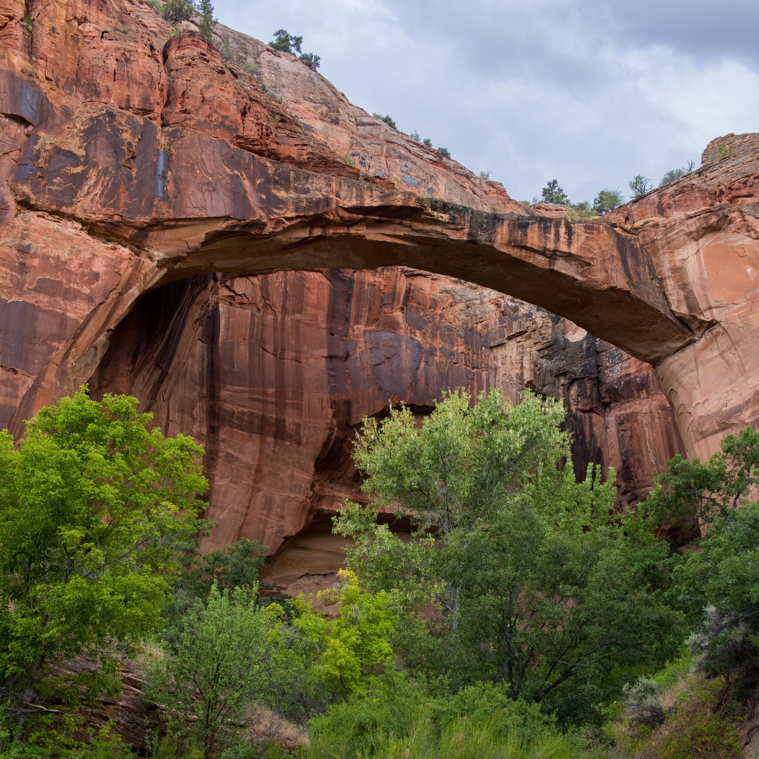
Escalante River to Natural Bridge (Arch)
This hike is not only one of the most beautiful parts of the 85-mile long canyon, it is also the easiest to reach, with friendly terrain unencumbered by dense brush thickets and boulder fields. Located between Boulder and Escalante, this easy trail crosses the Escalante River four times before reaching its destination of Natural Bridge.
How to get there from the Ranch: Turn right onto Hell’s Backbone Road and head back toward Hwy 12. Turn right onto Hwy 12 (south) and head approximately 13 miles. One the right you will see a green sign for “Escalante River” in front of a parking lot. Pick up the trail heading south. You will cross the river several times along the way, so be prepared with proper footwear. The first crossing is about 150 ft. from the parking lot. From the trail-head, take the right fork and follow the trail upstream into the canyon.
Distance: 3.2 miles round-trip
Difficulty: Easy
Season: Spring/Summer(April-June), and late Fall (mid-September-November)

Boulder Mail Trail
A great in-and-out hike that traverses the heart of Box-Death Hollow wilderness. The Mail Trail is one of the best slick rock routes in all of the Southwest. Walk along a juniper covered plateau as you follow the route of the old mail trail, along which the telegraph line is still visible, between the towns of Boulder and Escalante.